Tete Jaune Cache ("Yellowhead" in French), is located at the confluence of the Fraser and Robson Rivers, 11km (7 miles) west of Mount Robson and at the intersection of the Yellowhead Highway #5 (18 km/11 miles north of Valemount and 330 km/200 miles north of Kamloops) and Yellowhead Hwy #16 (266 km/165 miles east of Prince George and 101 km west of Jasper, Alberta).
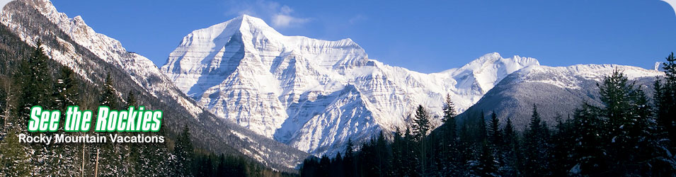
Nestled in the Robson Valley, Tete Jaune Cache is surrounded by three mountain ranges: the Rocky Mountains, Monashee Mountains, and the Premier Range (part of the Cariboo Mountains). Just 11 km away, the world heritage site, Mount Robson Provincial Park, is home to Mount Robson, the highest peak (3,954 m/12,972 ft) in the Canadian Rockies.
A historic point in the fur trade in the early 1800's, Tete Jaune Cache was also once a major construction center during the building of the Grand Trunk Pacific Railway, this was once a bustling community of 3,000 people and the head of navigation for the flat-bottom stern wheelers which brought railway supplies up the Fraser River.
Visitors to the area can enjoy a variety of outdoor adventures amid breathtaking natural scenery. Summer activities include whitewater rafting, backcountry and heli-hiking, horseback riding, sportfishing and ATVing. Winter activities include snowmobiling, heli-skiing or heli snowshoeing, x-country skiing, ice fishing and dogsledding.